Meridian Forest Services Limited offers a wide range of services from an experienced team of GIS professionals to forest companies, First Nations, private sector organizations, and all levels of government. Our GIS department utilizes ESRI ArcGIS 10.6 to develop, implement and manage our client’s spatial data while producing quality and accurate deliverables for those using our products. We have the capability to analyze, convert and export data in numerous formats that are compatible with other GIS systems.
Meridian’s expertise in coordinating LiDAR and imagery acquisition projects will help ensure maximum value from your LiDAR or imagery investment.
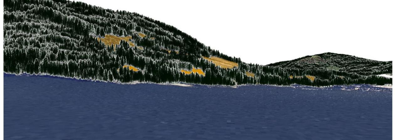
Effective spatial data management, mapping and analysis can provide meaningful support to your organizations' goals. Our professionals develop datasets and analyses, using remote sensing, GIS, and data management, that allows you to observe and understand key features of your project.
Meridian services include:
- Custom cartography
- Data Management
- 3D Visualization Models
- LiDAR and Aerial\satellite Imagery Acquisition and Planning
- Provide general LiDAR and imagery-related information and support
- Terrain Products (DEM, classified slope and aspect rasters, hillshade rasters)
- Forest Inventory Products (CHM, tree counts, timber volume)
Meridian’s products include:
- Forestry Development and Environmental Maps
- Operational mapping for cutblock layout - including Harvest & Road Plan\Permit, Appraisal, Site Plan, Timber Cruise, and Detailed and Overview Location Maps
- Wildlife\Danger Tree Assessment
- Visual Impact Assessments
- Tourism and Recreational Maps
- Mobile Mapping Applications – ArcGIS Collector App.